
AP
| Photo Credit: Hiro Komae
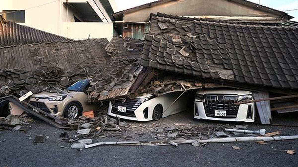
An earthquake with a magnitude of 6.8 hit Japan near the Kumomoto city on Tuesday (July 28, 2026). At least 28 people have been reported dead, and rescue efforts are ongoing to find survivors. A shopping mall collapsed after an explosion buckled the building, trapping those inside, just a month after reopening with seismic reinforcements. Around 170 soldiers had been dispatched for rescue.

Map showing the epicenter of the earthquake (mag. 6.8) on July 28 in Japan
Following the 6.8 magnitude earthquake, six other smaller quakes were recorded in the region in the next seven hours after the initial quake. Around 10,467 people were evacuated after the earthquakes, according to government data, power outages were reported in over 22,000 houses and water outages in over 74,000.

Map showing subsequent earthquakes in Japan on July 28
While seismic resistance compliance for buildings is high (around 90%) in Japan following successive overhauls of laws governing seismic-resistant construction, water pipeline seismic compliance rates are another matter.
For 2023, the percentage of the total water pipeline network that was found to be seismic-compliant was around 34%. This number was reported by Japan’s Ministry of Land, Infrastructure, Transport and Tourism, Water and Sewerage in an emergency assessment conducted after the 2024 earthquake in Noto Peninsula.
When it came to prefecture-level variations, some prefectures had as less as 10% to 15% seismic-compliance for water pipelines. The highest rate was 66%.
Regional seismicity
Japan’s history includes many recorded instances of earthquakes that have a magnitude over 6, given its geological position. The strongest in recent times was the earthquake in 2011, which had a magnitude of 9.1, and triggered a tsunami that killed over one lakh people.
In April 2016, three earthquakes wrecked the area around Kumamoto, causing around 240 deaths, and 2,800 injuries. Two foreshocks of magnitudes 6.2 and 6 preceded a main shock with a magnitude of 7, causing widespread damage to infrastructure triggered by landslides. Around 12,000 houses were damaged or destroyed, according the U.S. Geological Survey (USGS).
Looking at this year alone, the recent earthquake ranks third in terms of magnitude.
The USGS said that the July 28 earthquake’s shallow depth (10 km) indicated that it was the result of a crustal fault on the Eurasian plate itself, rather than one caused by the interaction of two different plates. The epicenter of the earthquake was northwest of the Ryuku Trench, the point where the Philpine Sea plate subducts under the Eurasian plate along a convergent boundary.

Map showing tectonic plate interactions near Japan
(With inputs from Reuters)
Published – July 30, 2026 04:42 pm IST
Leave a Reply